- List instances (includes all - also older model runs):
https://climathon.iblsoft.com/data/icon-de/edr/collections/height-above-ground/instances
- Instance query example for accessing older runs:
https://climathon.iblsoft.com/data/icon-de/edr/collections/height-above-ground/instances/20240406T000000Z/radius?coords=POINT(17.1785%2048.1628)&within=10&within-units=km¶meter-name=relative-humidity&z=2&datetime=2024-04-06T00:00:00&f=CoverageJSON
Note: You might need to update the value of ‘datetime’ parameter to a more recent time. The server keeps ICON-DE data only for the past two days. When outside of this interval, the server will respond with HTTP 204 (No Content).
GFS
Query Examples
- Formal description of the GFS data available in the server (a.k.a. metadata):
https://climathon.iblsoft.com/data/gfs-0.5deg/edr/collections
- Temperature in 2 metres above ground; IBL office location; April 6th 2024 07:00 UTC; output in CoverageJSON format:
https://climathon.iblsoft.com/data/gfs-0.5deg/edr/collections/height-above-ground/position?coords=POINT(17.1785 48.1628)¶meter-name=temperature&z=2&datetime=2024-04-06T07:00:00Z&f=CoverageJSON
- Accumulated rain between April 06th 7:00 UTC and April 06th 13:00 UTC (6h interval); IBL office location; output in CoverageJSON format:
https://climathon.iblsoft.com/data/gfs-0.5deg/edr/collections/single-layer_3/position?coords=POINT(17.1785 48.1628)¶meter-name=total-precipitation_gnd-surf_stat:acc/PT6H&datetime=2024-04-06T07:00:00Z&f=CoverageJSON
Note: You might need to update the value of ‘datetime’ parameter to a more recent time. The server keeps GFS data only for the past two days. When outside of this interval, the server will respond with HTTP 204 (No Content).
See API documentation for more information about the position query.
GEFS
Query Examples
- Formal description of the GFS data available in the server (a.k.a. metadata):
https://climathon.iblsoft.com/data/gefs-0.25deg/edr/collections
- Temperature in 2 metres above ground; IBL office location; April 06th 2024 06:00 UTC; output in CoverageJSON format:
https://climathon.iblsoft.com/data/gefs-0.25deg/edr/collections/single-level_2/position?coords=POINT(17.1785%2048.1628)¶meter-name=total-precipitation_gnd-surf_positively-perturbed_stat:acc/PT6H&datetime=2024-04-06T06:00:00Z&f=CoverageJSON
- Accumulated rain between April 06th 18:00 UTC and April 06th 06:00 UTC (6h interval); IBL office location; output in CoverageJSON format:
https://climathon.iblsoft.com/data/gefs-0.25deg/edr/collections/single-level_2/position?coords=POINT(17.1785 48.1628)&total-precipitation_gnd-surf_positively-perturbed_stat:acc/PT6H&datetime=2024-04-06T06:00:00Z&f=CoverageJSON
Note: You might need to update the value of ‘datetime’ parameter to a more recent time. The server keeps GFS data only for the past two days. When outside of this interval, the server will respond with HTTP 204 (No Content).
See API documentation for more information about the position query.
Climate Data
ERA5-Land Historical Monthly Means
Query Examples
- Formal description of the ERA5-Land data available in the server:
https://climathon.iblsoft.com/data/era5-land-monthly-means/edr/collections
- Time series of average January snow depths at IBL office location from 2000 to 2005:
https://climathon.iblsoft.com/data/era5-land-monthly-means/edr/collections/single-layer/position?coords=POINT(17.1785 48.1628)¶meter-name=snow-depth_gnd-surf_stat:avg&datetime=2000-01,2001-01,2002-01,2003-01,2004-01,2005-01&f=CoverageJSON
Note: ERA5-Land Monthly Averages dataset contains averages of meteorological variables over a period of one month. In time axis, 00:00 UTC of the first day of a month represents the whole month, e.g., time axis coordinate 2000-01-01T00:00:00 represents the whole month of January 2000.
ERA5-Land Historical Monthly Means by Hour of Day
Query Examples
- Formal description of the ERA5-Land data available in the server: https://climathon.iblsoft.com/data/era5-land-monthly-means-by-hour/edr/collections
- Average 15:00 UTC temperature over July for years 2010, 2011, …, 2015 at IBL office location: https://climathon.iblsoft.com/data/era5-land-monthly-means-by-hour/edr/collections/height-above-ground/position?coords=POINT(17.1785 48.1628)¶meter-name=temperature&datetime=2010-07-01T15:00,2011-07-01T15:00,2012-07-01T15:00,2013-07-01T15:00,2014-07-01T15:00,2015-07-01T15:00
Note: Time frame 2010-07-01 15:00 UTC represents average value of a parameter over 2010-07-01 15:00 UTC, 2010-07-02 15:00 UTC, … 2010-07-31 15:00 UTC.
HadGEM3 Future Climate Forecast
Query Examples
- Formal description of the HadGEM3-GC31-LL data available in the server:
https://climathon.iblsoft.com/data/hadgem3-gc31-ll/edr/collections
- Average total cloud coverage in May 2080 at IBL office location: https://climathon.iblsoft.com/data/hadgem3-gc31-ll/edr/collections/ssp1-2.6_single-layer/position?coords=POINT(17.1785 48.1628)¶meter-name=total-cloud-cover_atmosphere_stat:avg&datetime=2080-05-16&f=CoverageJSON
Note: HadGEM3-GC31-LL dataset contains averages of meteorological variables over a period of one month. In time axis, 00:00 UTC of the 16th day of a month represents the whole month, e.g., time axis coordinate 2080-05-16T00:00:00 represents the whole month of May 2080.


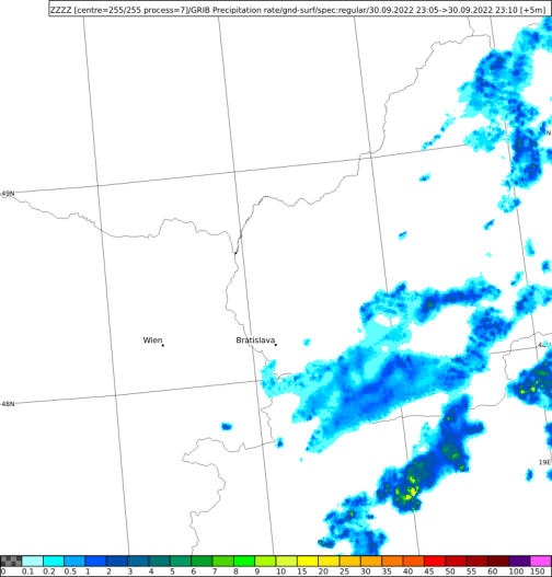
 - Data access (OGC API EDR): https://climathon.iblsoft.com/data/radar/edr